PROJECT
Soil erosion threatens the sustainable use of the world’s land resources, making it a problem of global importance. Despite recent advances in erosion modeling, predictive models and tools often rely on globally available data and their development lacks field activities and validation. These shortcomings limit applicability in identifying site-specific priority areas and measures for effective land management. Predict-Er brings a multidisciplinary approach that, for the first time, combines nuclear, analytical, statistical and remote sensing techniques to obtain high-resolution field data. The research results will be modeled and integrated into a new tool for predicting erosion intensity and sediment dynamics in a range of management scenarios. The user-friendly Web-GIS tool aims to support decision makers in choosing appropriate conservation measures to minimize the effects of erosion on and off eroded sites. The tool developed on a representative watershed in Serbia will be validated on a watershed with different physiographic-geological characteristics in Spain. Feedback from relevant stakeholders will be used to improve the design and performance of the tool. The best prediction models will be proposed to optimize the amount of input data for model parameterization in future applications in different regions. State-of-the-art research supporting the development of the tool will contribute to advancing knowledge of the drivers of soil erosion and sediment redistribution, increasing the team’s scientific excellence. Using the Predict-Er approach to support decision-making will significantly impact soil and surface water quality with consequent socio-economic benefits and impact on national and international politics.
Phases of the project:
– Analysis of the researched area – 1st month
– Management of activities, data and risks – from the 1st to the 36th month
– Plan for dissemination and exploitation – from the beginning of the project, the first 4 months, as well as on two other occasions during the project
– Knowledge sharing and communication – throughout the project
– Aerial photography and field research – first year
– Taking soil samples – from the 2nd to the end of the 18th month
– Analysis of soil samples – during the entire period of soil sampling
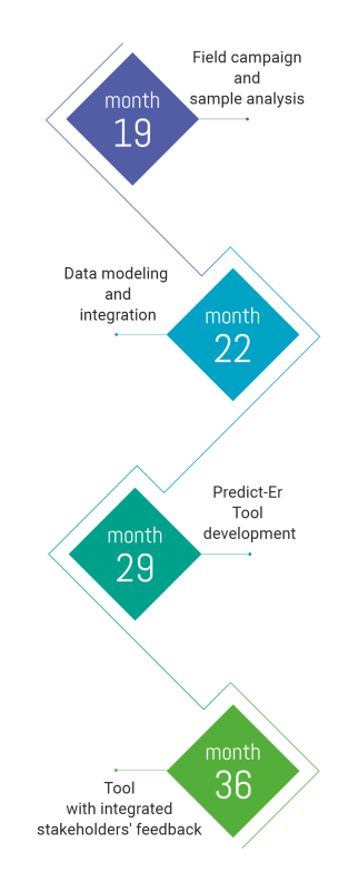
– Terrain and land use modeling – from the 4th to the end of the 15th month, following aerial surveys and field surveys
– Land redistribution modeling – from the 4th to the end of the 20th month
– “Fingerprinting” of sediments – in the 20th and 21st months, following aerial surveys and field research
– Multivariate and geostatistical modeling – in the 21st and 22nd months, working with the results of aerial photography and field research
– Integration of data collected by remote sensing and from the field – from the 23rd to the end of the 25th month using the results of fieldwork and data analysis
– User interface development (Web GIS portal) – from the 23rd to the end of the 25th month
– Implementation and validation of the tool – from the 26th to the 36th month

The scientific work in Predict-Er is structured in interconnected scientific work packages (see work packages), reflecting the major tasks that will be solved to successfully tackle the scientific targets of Predict-Er.
WP1 (Study of selected catchment, field campaigns, and sample analyses) aims to produce high-resolution datasets on the representative study catchment to be used directly or as modeled data for Predict-Er tool development. It includes analysis of the study area with the involvement of already mobilized stakeholders, aerial and terrestrial surveying of the area for obtaining highly detailed land cover and vegetation mapping, sampling of soils and sediments, and sample experimental characterization. Team leader – Boško Gajić, full professor.
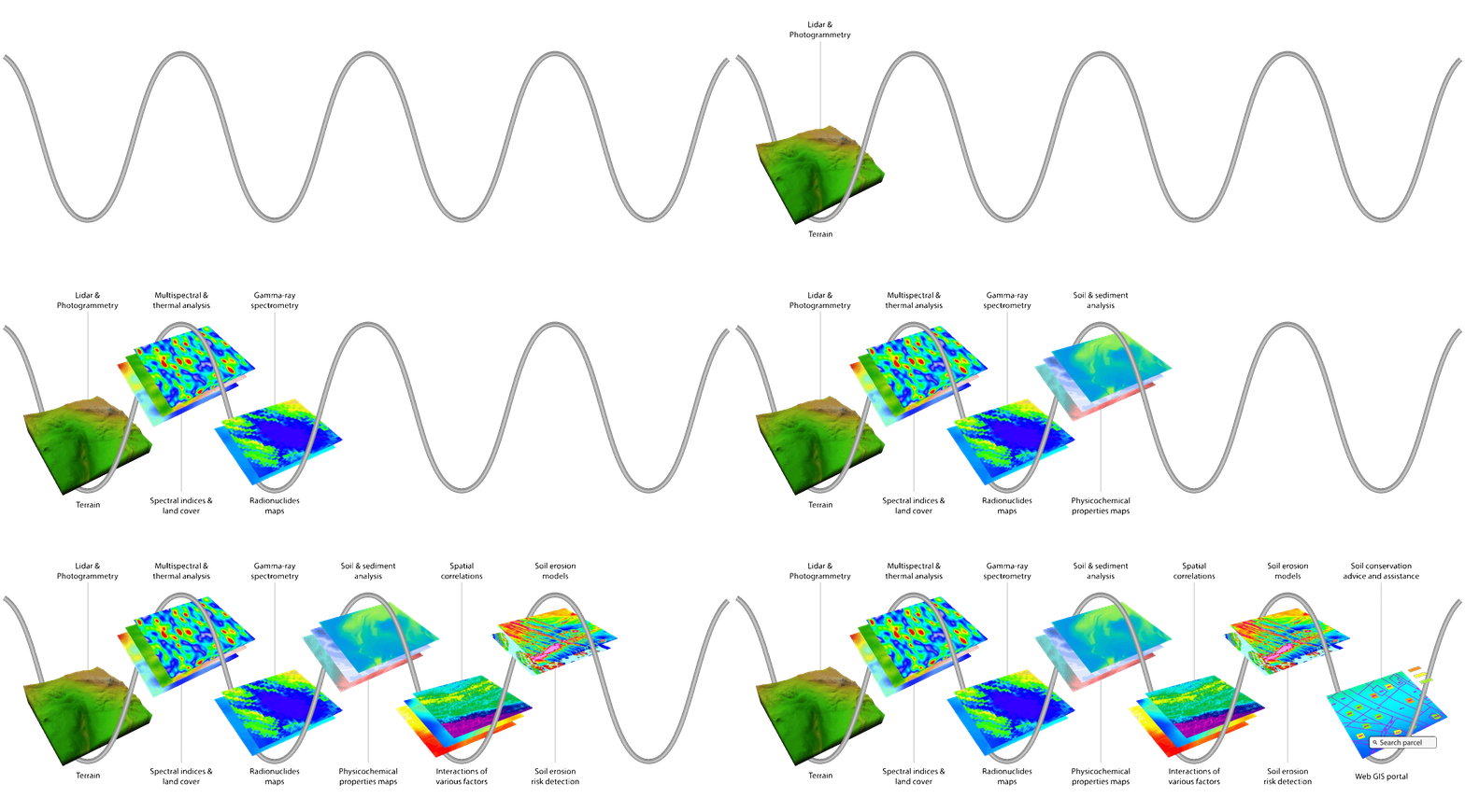
WP2 (Data analysis and modeling as a base for Predict-Er tool development) is modeling oriented, aiming to provide multilayer representation models (terrain, land cover, soil erosion rates, sediment fingerprinting) and analysis of the spatial distribution of physicochemical soil properties, stable element contents, radionuclide activities by multivariate and geostatistical methods to produce a base for the Predict-Er tool development. Team leader – Ivana Smičiklas, principal research fellow.
WP3 (Development and testing of the Predict-Er tool) is intended to develop and test the Predict-Er tool for predicting spatial and temporal trends of soil erosion and sediment transport. This WP includes integration of the remotely sensed data and data obtained by analyzing sampled soil and sediments, the development of a user-friendly Web GIS portal, analysis of end users’ feedback, and validation of the tool in the Spanish catchment. Team leader – Milan Đorđević, assistant professor.
WP4 (Project management and dissemination) aims to ensure effective activity, data, and risk management and to build an effective strategy to communicate and disseminate all project activities and outcomes and to raise awareness of the work and relevance of Predict-Er across the scientific community , stakeholders, end-users and the general public. Team leader – Snežana Dragović, principal research fellow.

